Duathlon Nationals Race Course Preview

>> Saturday, May 30, 2015

Well, my "A" race for the year (so far) is next weekend. I'm doing the short course race at Duathlon Nationals in St. Paul (2.5K run, 23K bike, 2.5K run - or 1.55 mile run, 14.3 mile bike, 1.55 mile run). I know Harriet Island pretty well, and I've biked up Ohio Hill countless times. I went out and took some photos of the bike course a few weeks ago, and I rode parts of the bike loop 3 days ago. Here are my thoughts on the course...

FIRST RUN:

The run loops all around Harriet Island (which, if you're from out of town, is not really an island - we are aware of this; no need to bring it up). It's flat. There are just a few TINY inclines.

We start at the highest point, run lower under the Wabasha Bridge, then back up a little bit to the turn-around on Levee Road. The little loop out on Raspberry Island is cute, and it's just slightly lower on the east end of the island. Then it's pretty flat along the river and back to transition. No biggie.

If you're doing the long course, you essentially do this meandering loop twice.

BIKE:

Here's the map of the loop:


Elevation chart. The short course does 2 loops; the long course does 3.

Early Wednesday morning, I rode to Harriet Island. I scoped out the run course (on my bike), and then did a hard 5-mile interval over the first 5 miles of the bike course. (I actually did 3x5-mile intervals at that point, but if you're here to hear about the course, you don't care about that.)

Here's the big thing you need to be ready for:

70 seconds.

Only 70 seconds into the bike course, you'll be heading up THEE Ohio Hill. It's not the worst hill ever, but it IS pretty big. You have VERY LITTLE time to get a drink and "relax" from the run before you're in your granny gear working up that hill.


Close-up of the start/end of the bike loop.


Looking up the start of Ohio.


Looking down from near the start of the hill.


A few blocks later near the top - note the cyclist going to the right.
We do NOT do this - we still go straight.

Where it looks like we run into houses about 1.5 blocks ahead in that last photo, the road curves to the left. We go 2 more blocks and turn onto George Street. At that point, we're STILL climbing a bit. Just keep this in mind: this hill just keeps going. You get a little flat after crossing Smith, and then you climb a bit more. You get about 1.5 miles in before you get a break. Then the roads get better and you start going downhill:


Looking BACK along the course about 2.5 miles in after coming down this nice gentle hill.
(These were taken from my car, and I drove part of the course backwards. Sorry for any confusion.)

Then you get to enjoy some speed. It's not out-of-control. You don't need to brake. There are small curves, but it's fine. Here's what it looks like looking BACK up into what you've just ridden down:


I hit 37 mph and all was good. (Again, looking BACKWARDS up the hills we ride down.)


Again, looking BACK after the straight open stretch on Hwy 13. Fast and flat.

When you're done on Hwy 13, you do the little "loop" to get down next to the river. This is a short, steep hill. Be careful at the start of this downhill because you CAN carry a little too much speed into the first part - you don't want to wipe out. But if you start to think "oh this curve is ending just up there," then you can book it. You can speed through the final part of that curve onto the straight downhill section. Watch for a big hose across the road just past the bottom of the hill (it comes from the Yacht Club, and it's like the size of a fire hose, but it wasn't there on my early morning ride, so I'm hoping it won't be there on race day).

Once down that little loopy downhill, it's flat along the river:


Moderately rough roads.


Some nice sections of new roads in there a mile later.

I have NOT rode the entire way through on Lilidale Road / Water Street since last fall because there have been "road closed" signs up for months. (And I've heard of bikers being ticketed if they go through, and it's just not worth it to me.) This SHOULD be opened up in time for the race. I hope. But it's pretty flat in there. There's a slightly deceptive false-flat about a mile before getting back to Harriet Island, and some of the road in there is a bit rough, but it's nothing too scary.

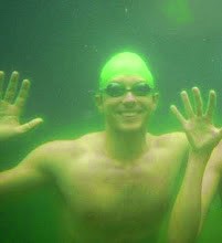
FYI, even if it's a dark, overcast day, you might still want to wear some sunglasses. This flat part along the river is usually a little gnat-filled. On Wednesday when I rode it, it was drizzling off and on, and it was around 5:00 a.m. (Yes really.) And I STILL rode through a lot of gnats! (Which I usually think of as an afternoon or evening problem.) Here's what I looked like once I got home around 6 a.m.:


I had 21 on my face post-ride, and it wasn't until an hour later that I saw the one IN MY TEETH.
Gross. (And yes, that's sweat dripping from my nose too. Double gross.)

Nearing the end of the 7 mile loop, you can see the Harriet Island Pavillion a block in the distance (transition will be set up right next to that), but you'll take a right at this intersection to start another loop:


Oh, and being I did the first 5 miles of the bike course as an interval on Wednesday, I figured I can share my Garmin data from those 5 miles:


First 5 miles in red. (My interval was between miles 6.8 and 11.8 miles into my longer ride.)

That's my speed from that 5-mile interval. You can see a burst of speed out of the park, and then down to 10-12 mph for a while up Ohio. FINALLY enjoyed some downhills about 2.5 miles in, then a little speed down the little loop to along the river around 4 miles in, with the final mile being flat along the river.

SECOND RUN:

It's pretty much the same run, only starting a bit "lower" in transition:


Just after the 2nd arrow, we head up a "ramp" to get on the upper bike path, and that will be just an annoying tiny incline right at the start of the run. (That 2nd arrow is through a little tunnel where we go under the upper bike path.) Then it's just like the first run, only we stay along the river to finish. So once we get off Raspberry Island, it's just about a 4 block sprint to the finish line!


THE SHORT VERSION: The runs are basically flat with tiny inclines. The hill is right away on the bike loop (that you'll do 2 or 3 times depending on if you're doing the short or long course), and it doesn't quite end when you think it should be done - it seems to linger on. But then you get to enjoy some "usable" downhills.

Oh, and the final thing worth noting is that I think this will be my first race with a noon start. The long course race starts around 8:00 a.m., but the short course doesn't start until noon. Weird. Well, wish me luck next weekend!

Click here for more info on the Duathlon National Championship's website. Sometime mid-next week I'll post my own goals and personal race strategy. Have a great weekend!

0 comments:

Post a Comment

Thanks for your comments! Have a great day!

Twitter

Follow steveinaspeedo on Twitter

Facebook Fan Page

All content and original images copyright 2006 - 2024 by Steve Stenzel, AKA "Steve in a Speedo." All Rights Reserved.
Want to use something seen here? Just ask - I don't bite.